Wight Drone

Call Directions Website Contact the business

Wight Drone Hello, and Welcome to Wight Drone. We are the Isle of Wight's UAV/Drone Specialist,

🌅 Yesterday's Sunset over Bouldnor Forest!A beautiful autumn evening on the Isle of Wight, with the golden autumn leaves...
08/11/2026

🌅 Yesterday's Sunset over Bouldnor Forest!

A beautiful autumn evening on the Isle of Wight, with the golden autumn leaves across Bouldnor Forest catching the last of the day's sunlight, and Yarmouth visible in the distance.

The changing colours of the season make for some stunning views from above, especially when combined with another beautiful sunset! 🍂🚁

📍 Bouldnor Forest, Isle of Wight

Where will we be next? Follow Wight Drone to find out!

Need a drone service? From roof inspections and thermal surveys to aerial mapping, 3D modelling and specialist data collection, we're here to help.

📞 07952 913430

Like, share and follow our page to see more of the Isle of Wight from a different perspective!
🌊 HELLO SHANKLIN!!Last week, one of our stops took us over to Luccombe to carry out a roof inspection. Of course, while ...
03/11/2026

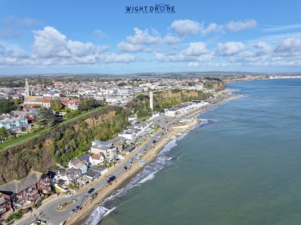
🌊 HELLO SHANKLIN!!

Last week, one of our stops took us over to Luccombe to carry out a roof inspection. Of course, while we were in the area, we couldn't resist capturing a few images of beautiful Shanklin Beach!

These were taken as the last rays of October sunshine were disappearing, giving us some lovely views along the coastline. 🌅

📸 Here's a little look at what we captured!

Where will we be next??? 👀
Follow our page to find out!

🚁 Need a drone service?

From drone roof inspections and surveys to construction site mapping, 3D modelling, thermal inspections and aerial data collection, Wight Drone offers a range of professional drone services across the Isle of Wight and beyond.

📞 07952 913430
🌐 www.wightdrone.com
📩 [email protected]

Feel free to drop us a message or give us a call to discuss your requirements!

🌅 A beautiful sunset over Lymington Harbour!Yesterday evening on our return journey from a busy trip down to Dorset and ...
01/11/2026

🌅 A beautiful sunset over Lymington Harbour!

Yesterday evening on our return journey from a busy trip down to Dorset and Cornwall, we were treated to this fantastic sunset over Lymington Harbour with Wightlink Isle of Wight Ferries coming in.

We've been covering quite a few miles while the sun was out, carrying out a variety of specialist drone work, including thermal solar PV inspections, aerial data capture and site mapping.

It's always a bonus to finish a busy day of travelling and data collection with views like this! 🚁

At Wight Drone, we're providing specialist aerial services across the Isle of Wight and mainland UK, including:

📸 Aerial Photography & Data Collection
🏠 Roof Inspections & Surveys
🌡️ Thermal Imaging & Solar PV Inspections
📍 Site Mapping & Geospatial Data
🏗️ 3D Modelling & Surveys

Have a project that could benefit from drone data collection? Get in touch!

🌐 www.wightdrone.com
📞 07952 913430
📧 [email protected]

🌊 Hello Blackgang Chine- Land of Imagination! 🚁It’s been a while since we last shared some pictures from our trips aroun...
28/10/2026

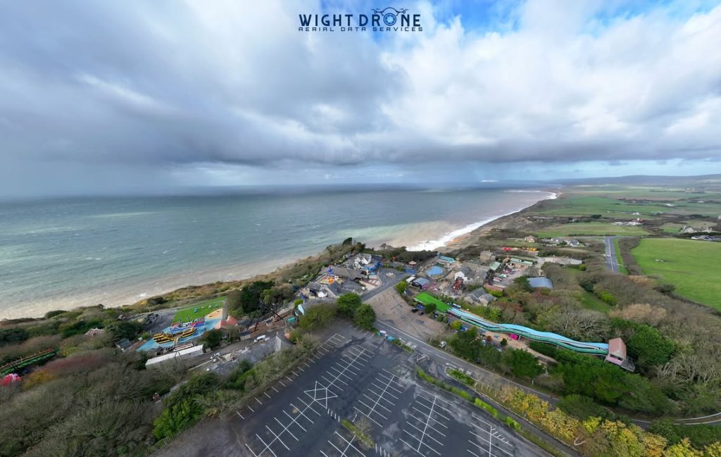
🌊 Hello Blackgang Chine- Land of Imagination! 🚁

It’s been a while since we last shared some pictures from our trips around the Island, so we thought it was time to share a few from today’s work!

We visited several locations across the Island, starting at Blackgang Chine – Land of Blackgang Chine- Land of Imagination, before heading across to Shanklin, Sandown and Newport to carry out a number of roof inspections.

📸 Here are a couple of views from Blackgang this morning, including a look along the spectacular Military Road, with The Needles visible in the far distance! 🌊

At Wight Drone, our work takes us all over the Island and beyond, collecting high-quality aerial data to help our clients make informed decisions and move their projects forward.

🚁 Need a drone service on the Isle of Wight?

We provide a range of professional aerial services, including:

🏠 Property imagery and aerial data capture
🔍 Drone roof inspections and detailed roof surveys
🗺️ Geospatial data collection, mapping and 3D modelling
🌡️ Thermal imaging and heat-loss surveys
📐 Accurate site data and survey deliverables

Whether you’re a homeowner, property professional, surveyor or construction company, get in touch with Wight Drone and let us elevate your project!

📩 Message us directly, Call 07952 913430 or visit www.wightdrone.com to find out more.

📍 Where will we be flying next? Follow our page to find out!

26/10/2026
26/10/2026

Last week, before the storms grounded us, we were out with the M400 and P1 at a solar site capturing detailed aerial data to support a planned extension. ☀️🚁
We provided our client with a high-accuracy map, digital terrain model, digital surface model and contour data, giving their design team a detailed picture of the site and its elevations to help plan the expansion.

🏴 **Scotland, Solar Sites & A Surprise Cruise Ship! 🏴**A few weeks ago, we headed up to Scotland for **14 days of work a...
18/09/2026

🏴 **Scotland, Solar Sites & A Surprise Cruise Ship! 🏴**

A few weeks ago, we headed up to Scotland for **14 days of work across two solar sites**, providing our client with some specialised data collection and multiple highly accurate orthomosaic maps of the sites, delivering data down to **1cm accuracy**.

During our stay, we travelled across the **Firth of Forth almost daily**, passing the incredible Forth Bridge — one of Scotland’s most recognisable landmarks and a UNESCO World Heritage Site.

One evening, on our way back to base, we decided to stop and get the drone up to capture a few images of the bridge and hopefully some video.

We certainly weren't expecting what happened next! 😲

Not long after getting airborne, **Fred. Olsen Cruise Lines' Balmoral** appeared and sailed underneath the Forth Bridge before continuing out to sea. 🚢

Balmoral is one of Fred. Olsen’s smaller cruise ships, measuring almost **219 metres in length** and capable of carrying around **1,250 guests** — and seeing her pass beneath the bridge made for a pretty special unexpected moment!

📸 We managed to capture some great images, and there is also some video footage which we'll share at some point.

Unfortunately, we've been **far too busy with work recently to keep up with all our social media**, but we've got plenty of footage and data from our recent projects that we'll hopefully get around to sharing!

From solar surveys and mapping to inspections, thermal work and specialist aerial data collection — it's certainly been a busy few months for Wight Drone!

**Where will we be flying next?**
Follow us to find out! 🚁

🚢 Sky Princess Leaving Southampton!Back in June, while we were out in West Cowes capturing image data for a client, we s...
10/09/2026

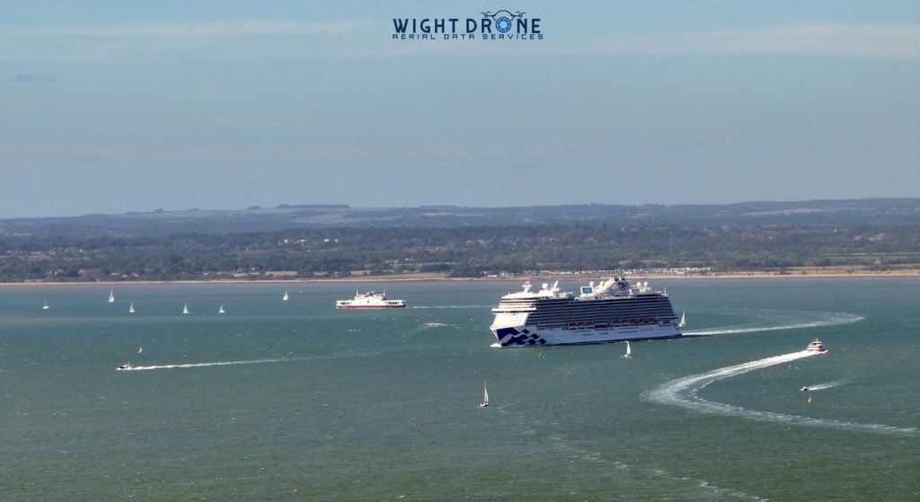
🚢 Sky Princess Leaving Southampton!

Back in June, while we were out in West Cowes capturing image data for a client, we spotted the impressive Sky Princess making her way out of Southampton.

During one of our wide-angle images of the local area, we managed to capture her in the distance. Thanks to the unique three-camera payload on our drone, we were able to capture the ship without needing to push the drone regulations set out by th CAA

And what a ship she is! 😍

The Sky Princess is a Royal-class cruise ship operated by Princess Cruises. She measures around 330 metres (1,083 ft) long, stands approximately 66 metres (217 ft) high, and has 19 decks. She can accommodate around 3,660 guests, supported by approximately 1,346 crew, and can reach speeds of up to 22 knots.

Built by Fincantieri in Italy, Sky Princess entered service in 2019 and features everything you'd expect from a modern cruise ship, including multiple restaurants, theatres, pools, entertainment venues and even Movies Under the Stars.

From West Cowes, it's always great to catch a glimpse of the cruise ships heading in and out of Southampton — and even better when we can capture them as part of our aerial data collection! 📸🚁

📍 West Cowes → Southampton

Where will we be flying next? 👀
Follow Wight Drone to find out!

🚁 HELLO SOUTHAMPTON!!!We were limited to a maximum height of just 40 metres at this location, but that was still high en...
08/09/2026

🚁 HELLO SOUTHAMPTON!!!

We were limited to a maximum height of just 40 metres at this location, but that was still high enough to capture a great view of St Mary’s Stadium! ⚽🏟️

A few months ago, we carried out a roof survey on a warehouse just outside Southampton city centre.

This particular site required a little extra planning due to its location in relation to Southampton Airport. With the correct planning, permissions and operating procedures in place, we were able to safely capture the client’s roofs with high-quality aerial imagery.

But we didn’t stop at just images…

📸 Detailed roof imagery
🏗️ Full roof coverage
🧊 A 3D model of the roof area
📊 Data that gives the client a much clearer view of the condition of their property

It’s a great example of how careful planning and the right equipment can allow us to capture valuable data even when operating restrictions are in place.

Where will we be next? 👀

Follow Wight Drone to find out!

🌈 The first time I’ve ever managed to capture a full rainbow — and a double bow! 🌈This was captured down west at Chulmle...
23/08/2026

🌈 The first time I’ve ever managed to capture a full rainbow — and a double bow! 🌈

This was captured down west at Chulmleigh while I was unloading the car full of gear, getting everything charged up and ready to begin transferring data.

Luckily, I had the M3 Pro with me, so I quickly grabbed a wide-angle shot before this amazing rainbow disappeared! 📸

It’s been a while since we last shared something, but that’s because we’ve been incredibly busy!

Over the past few months, we’ve travelled from the Isle of Wight to Scotland, Wales, Essex and down west to Truro, and we haven’t stopped!

We’ve been carrying out:
🚁 Construction mapping
🌡️ Thermal scans
🏢 Inspection data capture
🏠 Roof inspections & surveys
📊 Processing client data into accurate deliverables
🎥 Light aerial video capture

Across all of this, we’ve collected terabytes of data and clocked up over 150 hours of flight time!

And we’re still going! This week we have several roof inspections and surveys across the Island, followed by trips up towards South West London for some rather exciting data collection. 👀

Thinking about getting a better look at the condition of your roof?

We provide safe, professional and legal drone services, capturing clear, sharp aerial imagery using the right equipment for the job.

Whether you need a simple visual inspection or a more detailed survey and data set, we can help you see what’s happening on your roof without the need to get up there yourself.

📍 Covering the Isle of Wight and beyond.

Address

St Geoges Way
Newport
PO302QH

Alerts

Be the first to know and let us send you an email when Wight Drone posts news and promotions. Your email address will not be used for any other purpose, and you can unsubscribe at any time.

Contact The Business

Send a message to Wight Drone:

Share

Nearby photography services